

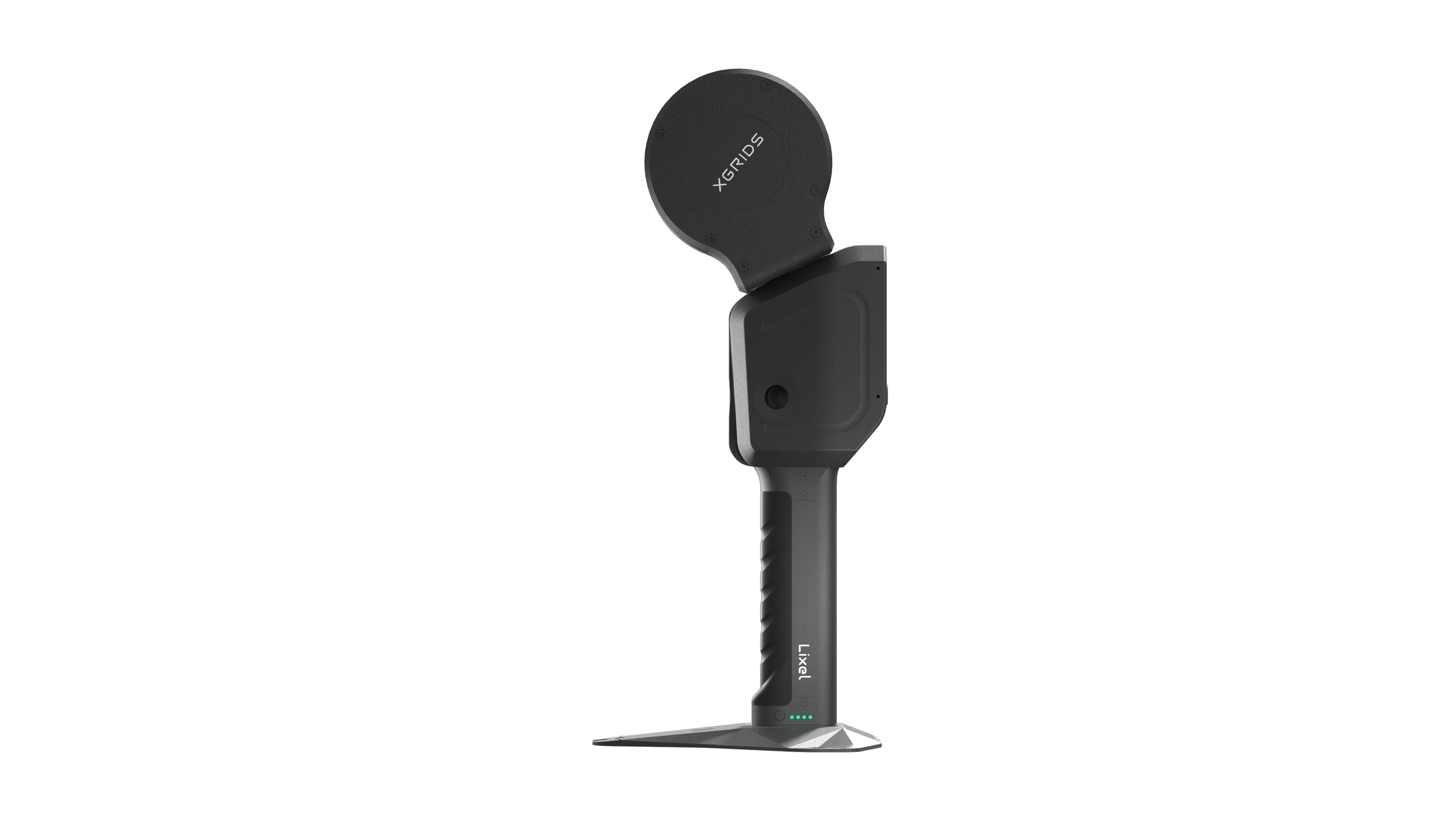
Lixel L2
The Lixel L series product is a handheld real-time 3D reconstruction device innovatively launched by XGRIDS. It integrates visual modules, LiDAR, high-precision inertial navigation and high-performance computing modules, and is easy to operate. It is built-in with self-developed reconstruction algorithm for 3D data collection and modeling, generating real-time color point cloud models, and can achieve seamless connection between field work and lab work through remote collaboration. Alternative to Matterport
The Lixel L2 (16/120 version) is a 3D scanning and reconstruction device introduced by XGRIDS. Integrated with modules such as LiDAR, 3 color camera, high-precision inertial navigation, and high-performance computer, the Lixel L2 seamlessly combines data capture with real-time modeling, producing true-color point cloud models with cm-level accuracy in real-time.
Centimeter-Level Precision to Meet Various Industrial Demands


±1.2cm
(Relative Accuracy)

≤2cm
(Repeat Accuracy)

≤3cm
(Absolute Accuracy)
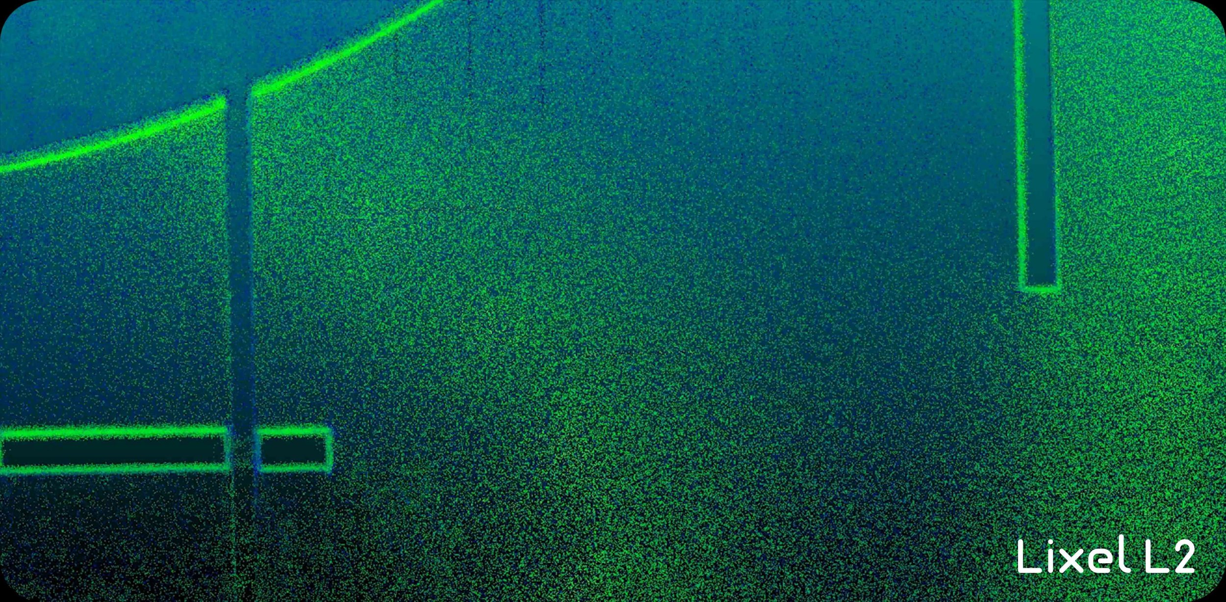
Outstanding Point Clouds, Visible to Naked Eyes
Thin: Point cloud thickness within 1cm


Clean: Significant reduction in noise points
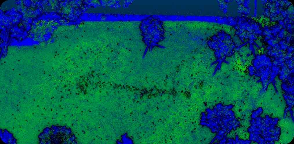

Uniform: Even and delicate point clouds, for more accurate measurements

Real Product Image


Main Application
Energy & Mining
Facing frequently changing needs of data monitoring in energy fields, to enable industrial digitalization.XR & Robotics
Integrated perception and algorithms for real-time spatial mapping and positioning provide solutions of holistic spatial awareness and intelligent decision making.VR & Metaverse
Photorealistic metaverse space interaction and management solutions which enable 1:1 replication of real spaces and person-alized metaverse experiences.Mapping & GIS
Real-time capture & modeling solutions to reshape survey-ing workflows, 5-10x efficiency for field & office works.Smart Cities
City BIM/CIM model generating, above & underground space integration to empower full lifecycle city management.Emergency & Security
Rapid acquisition of onsite 3D models and real-time transmition for emergency response data support.


