
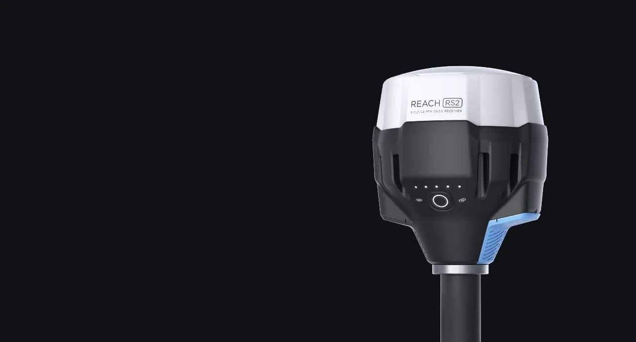
Multi-Band RTK GNSS Receiver With Centimeter Precision
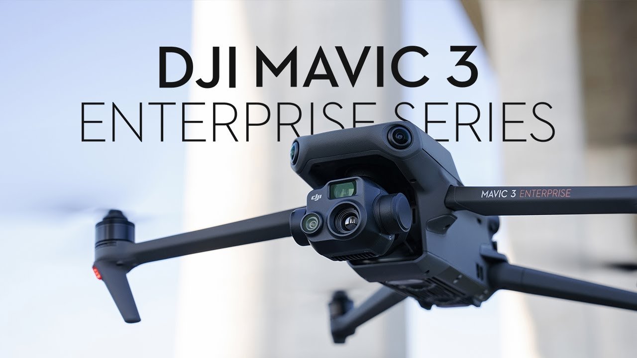
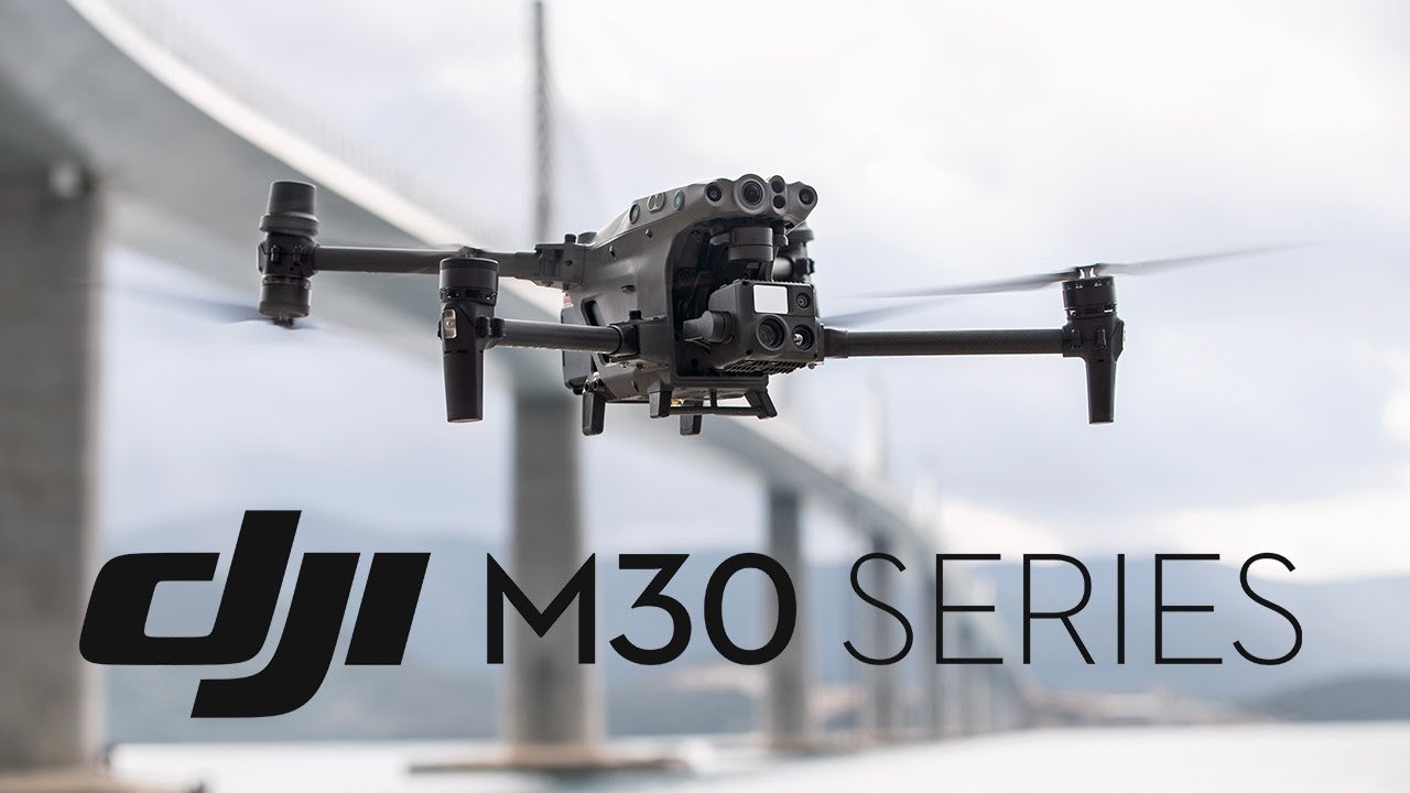
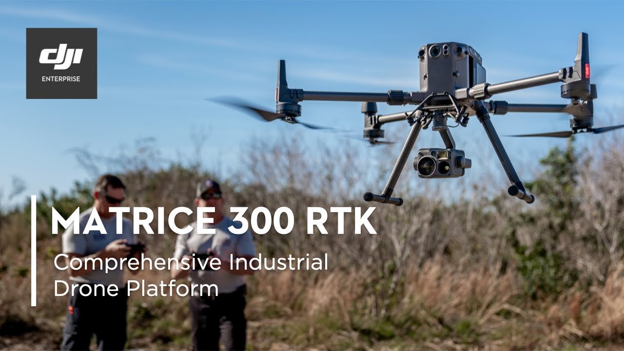
Real-time position streaming in NMEA. Reach provides data in standard NMEA that is used by most GIS apps. Simply connect your device to Reach over Bluetooth or with a cable, and turn on “Position output” in ReachView 3. Reach is able turn on and off in sync with an external battery connected over RS-232. RS2 is also compatible with DJI M3E, M30T, and M300.
Gets a fix in seconds
Reach RS2 gets a fixed solution in just seconds and maintains robust performance even in challenging conditions. Tracks GPS/QZSS L1C/A, L2C GLONASS L1OF, L2OF BeiDou B1I, B2I Galileo E1-B/C, E5b.
PPP Support
RINEX raw data logs are compatible with PPP services so you can now get centimeter-precise results in any place on Earth. Process RINEX files in an online service and get position with absolute accuracy.
22 hours on 1 charge
Up to 22 hours of autonomous work when logging data and up to 16 hours as a RTK rover, even in cold weather Reach RS2 can charge from a USB wall charger or a power bank over USB-C.


Build To Sustain
IP67
RS2 is waterproof up to 1 m depth. All connectors are completely sealed and protected from water and dust with silicone plugs.
-20 to +65 ºС
We extensively tested Reach RS2 in conditions that simulate coldest winters and hottest summers.
Polycarbonate body
Polycarbonate, an extremely durable material that is used in bulletproof glass, makes Reach RS2 impact-resistant.
Industrial battery
LiFePO4 Industrial battery that handles both high and low temperatures well.

REACH RS2
Compact and lightweight
126 х 142 mm - 950 g
Covered with elastomer
This is a rubber-like material that forms a shock absorber around the whole device. In a sophisticated manufacturing process, elastomer is permanently bonded to the polycarboante base so that if your bipod falls over, Reach RS2 will bump off, no marks left.
LoRa radio
868/915 MHz Frequency range
Up to 8 km at only 100mW
300% more range compared with FSK radios at the same power
RS2 is compatible with DJI System
Mavic 3 Enterprise & Thermal
Matrice 30
Matrice 300
SPECIFICATIONS
| Mechanical | Electrical | Positioning | |||||
|---|---|---|---|---|---|---|---|
| Dimensions | 126x126x142mm | Autonomy | Up to 16 hours as 3.5G RTK Rover, 22h Logging |
Precision | Static | H: 4mm+0.5ppm V: 8mm+1ppm |
|
| Weight | 950g | Battery | LiFePO4 6400 mAh, 6.4V | PPK | H: 5mm+0.5ppm V: 10mm+1ppm |
||
| Operating tempt | -20 to +65C (-4a 149F) | Charging | USB Type-C, 5V 2A | RTK | H: 7 mm+1ppm v: 14 mm+1ppm |
||
| Ingress protection | IP67 water and dustproof |
External power input | 6-40 V | Convergence time | ~5s Typically | ||
| Signal Tracked | GPS/QZSS L1C/A, L2C, GLONASS L1OF, L2OF, BeiDou B1I, B2I, Galileo E1B/C, E5b |
||||||
| Number of Channels | 184 | ||||||
| Update Rate | 10Hz GPS/5 Hz GNSS | ||||||
| IMU | 9DOF | ||||||
| Connectivity | |||||||
| UHF LoRa radio | Frequency range | 868/915MHz | |||||
| Power | 0.1W | ||||||
| Distance | Up to 8 km | ||||||
| 3.5G modem | Regions | Global | |||||
| Bands | Quad-band, 850/1900, 900/1800MHz |
||||||
| Sim Card | Nano SIM | ||||||
| Wifi | 802.11 b/g/n | ||||||
| Bluetooth | 4.0/2.1 EDR | ||||||
| Data protocols | NTRIP. VRS, RTCM3, Position output in NMEA, LLH/XYZ |
||||||
| Data logging | RINEX at update rate up to 10Hz | ||||||
| Internal Storage | 16GB | ||||||


