

PHANTOM 4
MULTISPECTRAL
Gather precise plant-level data using the P4 Multispectral – a high precision drone with a seamlessly integrated multispectral imaging system built for agriculture missions, environmental monitoring, and more. Suitable for Plant-Based Missions in Singapore! Contact us for more info!
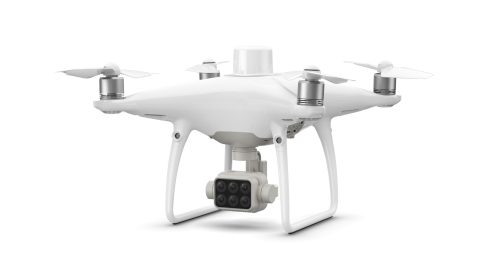
The P4 Multispectral is a fully integrated multispectral imaging drone designed for precision agriculture and environmental management.
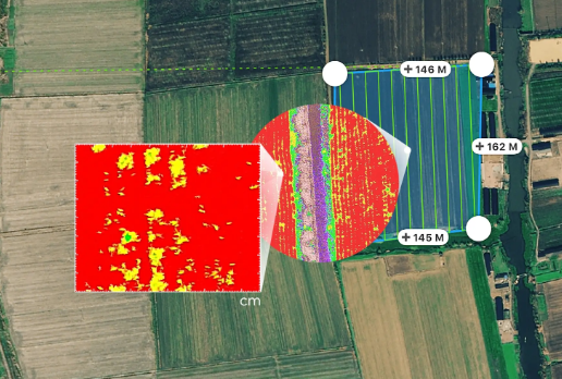
Combining data from six separate sensors to measure the health of crops, from individual plants to entire fields, as well as weeds, insects and a variety of soil conditions, the P4 Multispectral sets a new standard for easy-to-use agricultural drone applications.
Features
Precise Multispectral Imaging
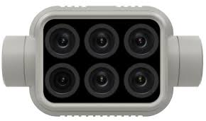
1 RGB and a multispectral camera array with 5 cameras covering Blue, Green, Red, Red Edge, and near Infrared bands.
Integrated Spectral Sunlight Sensor
Captures solar irradiance, which maximizes the accuracy of data collection through different times of the day.
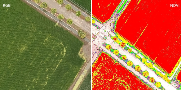
Live RGB and NDVI View - Switch between a preliminary Normalized Difference Vegetation Index (NDVI) analysis and the live RGB feed
Flight Performance
Pilots can calibrate the drone’s new centre of gravity with ease from the DJI Pilot app for better performance.
Data Accuracy
Integrated RTK positioning module and TimeSync system support real-time, accurate positioning data for each image.


